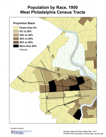
This digital map drawn from the 1940 U.S. Census shows the racial/ethnic configuration of the Mill Creek neighborhood before World War II. In 1940, the African-American population of West Philadelphia was concentrated within a few blocks north of Market St. Mill Creek was located at the center of that area. About 70 percent of the adult African Americans were born in southern states and moved north as part of the Great Migration.
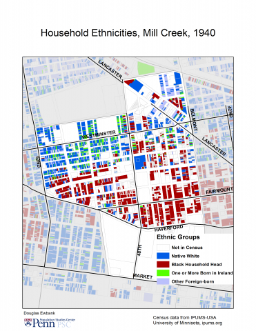
Just under half of Mill Creek was white. Twenty-one percent of the adults were foreign-born. The majority was born in Ireland. Many of the Irish-born were Catholics, living near Cathedral Park Cemetery.
As shown here, the neighborhood is properly described as racially/ethnically “mixed.” Yet while blacks and whites lived relatively close to one another, Brown Street (visible though unnamed on this map) divided the predominately white—i.e., native-white and Irish-born—blocks above that street from the predominately black blocks below it.