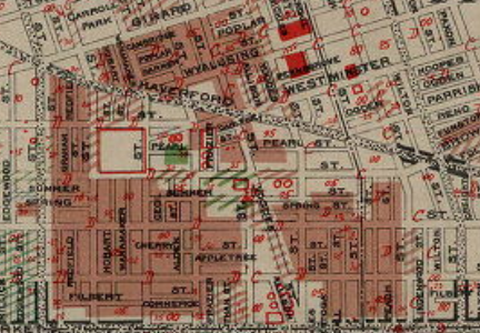
Haddington in 1934

J.M. Brewer’s Map of Philadelphia, 1934.
Brewer was the Metropolitan Life Insurance Company’s chief appraiser for the Philadelphia district. His detailed block-level map, printed in two sections, North and South, was used by the federal Home Owners’ Loan Corporation (HOLC), whose redlining maps were to govern the nation’s home-lending policies and practices for the next three decades.
Brewer’s color-coded map shows Haddington’s population as African American (brown), excepting a small concentration of Italians (green). In the redlining scheme, the neighborhood had a D rating, which would disqualify it for federally insured mortgages or housing conservation.
Italians dominated the blocks west of 63rd St. below Haverford Avenue.
Map Collection, Free Library of Philadelphia.