Mapping the Commercial Museum and Its Environs
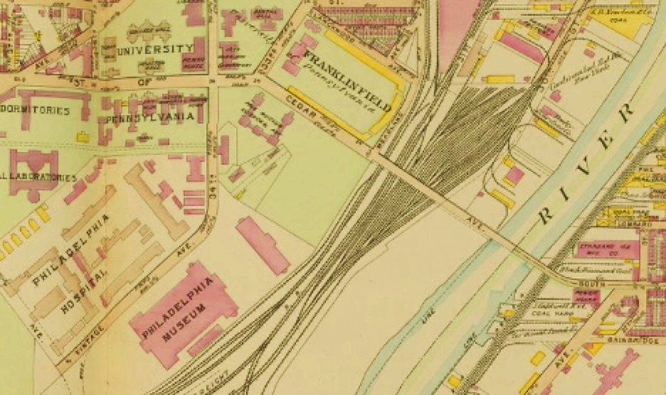
This Bromley map excerpt shows the Commercial Museum at bottom left, identified as “Philadelphia Museum,” with the Philadelphia Hospital (Blockley Almshouse) to the immediate west, and the Free Museum of Science and Art (now the Penn Museum) along Cedar (now South) Street to the near north. The Schuylkill River is on the Museum’s east flank.
1910
Copyright
Attribution/Credit
George W. Bromley & Walter S. Bromley, Atlas of the City of Philadelphia (Philadelphia: G.W. Bromley & Co., 1910), plate 23; Athenaeum of Philadelphia, via Philadelphia Geohistory Network