Advanced Search
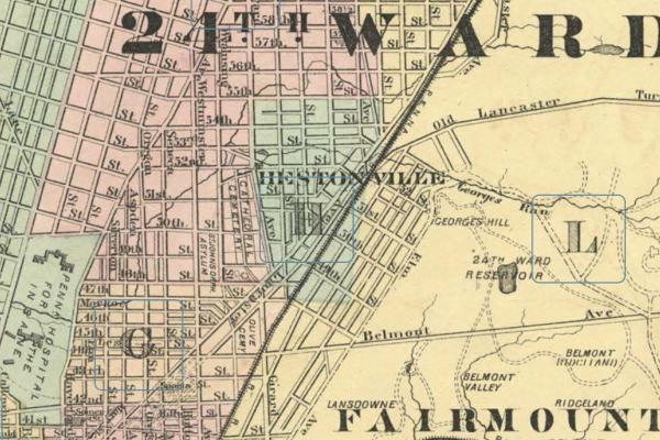
The 1872 Hopkins map frontispiece for the 24th Ward shows Hestonville in relation to Lancaster Avenue above 48th St.
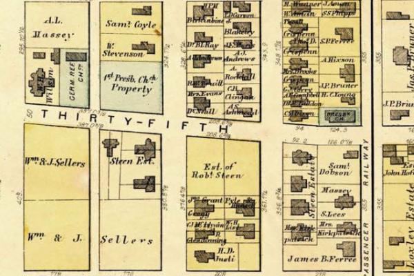
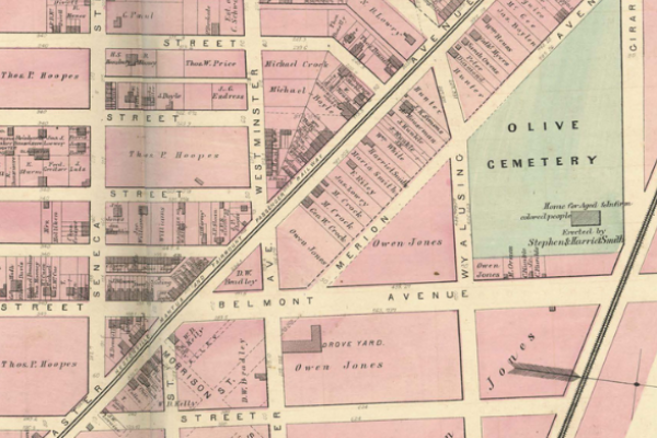
Two Protestant church holdings appear in the sample blocks on the 1872 Hopkins map: German Reform Church (building) and an undeveloped property owned by the First Presbyterian Church.

In 1682, William Penn entered into purchase agreements with the Lenape that brought lands deeded to his proprietorship under his absolute title.
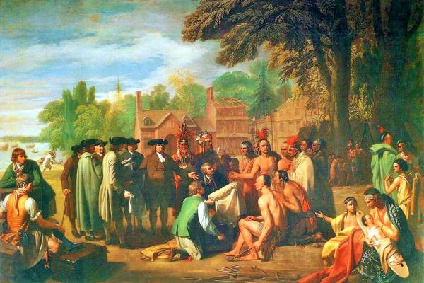
In 1682, William Penn entered into purchase agreements with the Lenape that brought lands deeded to his proprietorship under his absolute title.
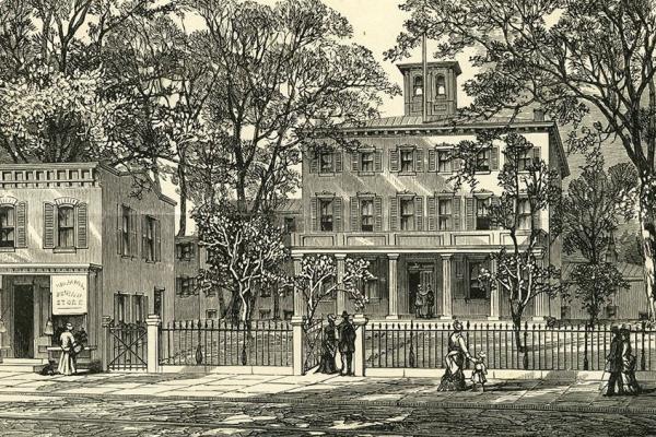
This illustration shows the Pennsylvania Working Home for Blind in the mid-1870s, when the organization acquired the former Mission House of the Protestant Episcopal Church.
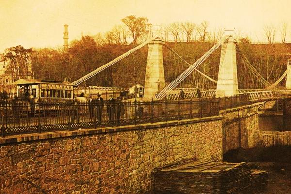
Looking east, Charles Ellet’s wire suspension bridge at the mid-point of the second half of the 19th century; Spring Garden St. crossing the Schuylkill.
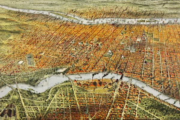
West Philadelphia, officially part of the City of Philadelphia as of 1854, rises west of the Schuylkill River (top).
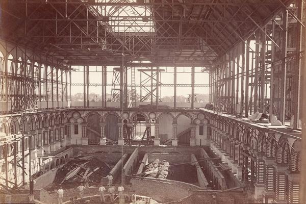
This albumen print shows the status of the building’s construction in Sept. 1875.
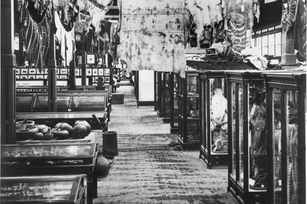
American Indian artifacts were exhibited in the U.S. Government Building in partnership with the Smithsonian Institution.
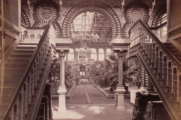
View into Horticultural Hall, probably just before the opening of the Centennial Exposition.
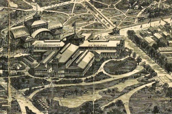
The splendid Davis–Newell “balloon” map of the Centennial Exposition grounds, showing in this excerpt the Women’s Pavilion on Belmont Ave. located directly opposite the U.S. Government Building.