Martha Washington 1927
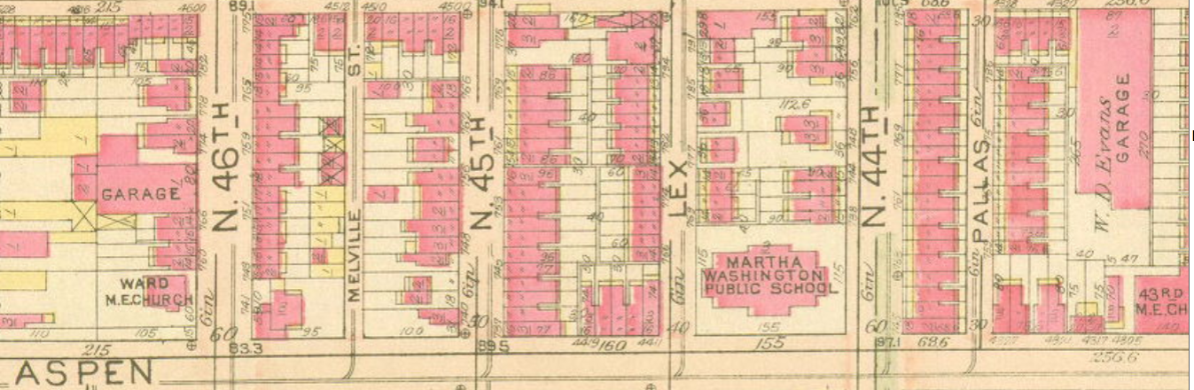
Martha Washington School, shown on the Bromley map of West Philadelphia in 1927, on the block of Fairmount, Aspen, and Lex Street.
The School District of Philadelphia’s extension of the Martha Washington playground in the 1960s removed Lex St. between 44th & 45th above Fairmount and gave the school the entire block from Fairmount to Aspen between 44th and 45th streets.
Martha Washington Elementary School was racially segregated during the second half of the twentieth century—and it remains so today. The entrance to the school’s playground on Aspen Street stood just yards from the doorstep of 816 N. Lex St., where the city’s worst mass shooting occurred on 28 December 2000.
1927
Copyright
Attribution/Credit
George W. & Walter S. Bromley, Atlas of the City of Philadelphia (West Philadelphia),1927 (Philadelphia: G.W. Bromley Co), plate 5; made available by Athenaeum of Philadelphia