Advanced Search
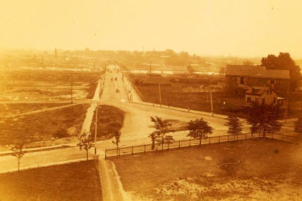
This 1891 photograph from the east tower of College Hall looks east toward Cedar (now South Street) and the Schuylkill River. The potter’s field that would become Franklin Field is visible in a depression to the left (north) of Cedar.
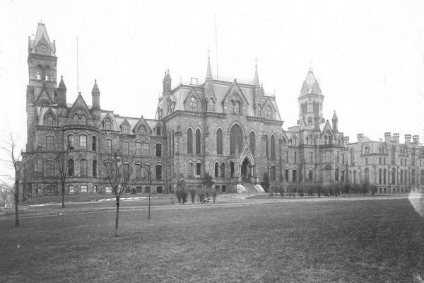
College Hall was the first University of Pennsylvania building to rise in the 10-acre tract of Blockley Almshouse property purchased by the Penn trustees in 1870. It was designed by the architect Thomas Webb Richards, built with green serpentine stone, and opened to students in 1892.
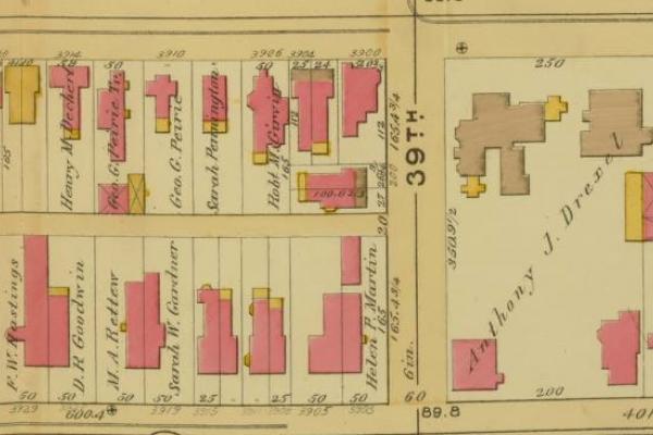
This 1892 Bromley map excerpt shows mansions and greenspace owned the family of the financier Anthony J. Drexel Sr., founder of the Drexel Institute of Art, Science and Industry.
This section of the Bromley map from 1892 shows the upper half of Haddington, from 59th to 64th between Haverford and Vine. The section shows assorted, though not densely filled, blocks of housing, a fire department and police station, Jesse George public school, and three churches (Presbyterian, Methodist, Catholic). Roughly half of the area is undeveloped.
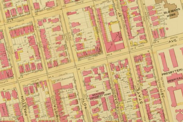
Showing a section of the West Powelton neighborhood, this 1892 map excerpt illustrates the prevalence in West Philadelphia of “benevolent, charitable and humane institutions,” in this case, Presbyterian Hospital, Old Man’s Home, and Western Temporary Home.
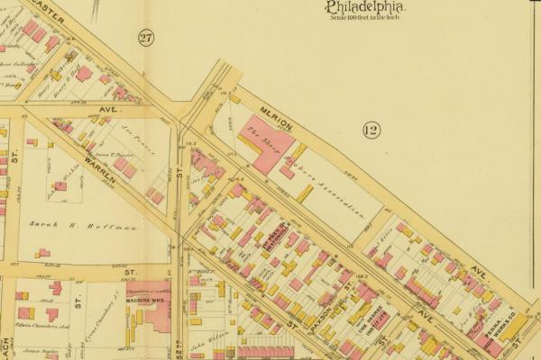
The Sheep Brokers Association in Hestonville, 1892, on the north side of Lancaster Avenue, a future site of housing development.
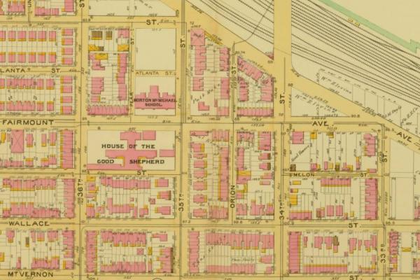
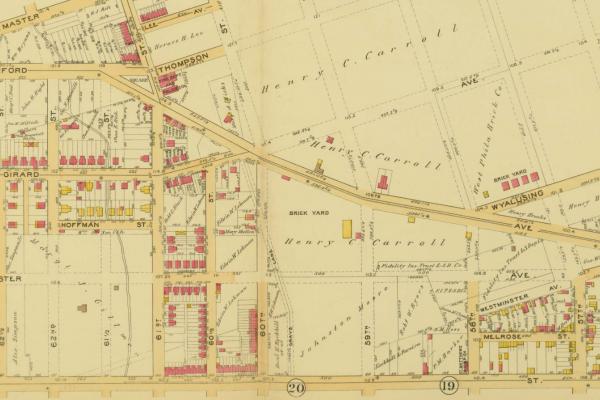
This Bromley map excerpt shows the eastern tier of Mantua between 36th Street and the tracks of the Pennsylvania Railroad above the west bank of the Schuylkill River. The neighborhood’s public school is at lower left, the northeast corner of Mt. Vernon and 38th streets.
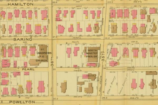
By 1892, the German Reform Church is gone, and the Northminster Presbyterian Church now has a building on the property owned by the First Presbyterian Church in 1872.
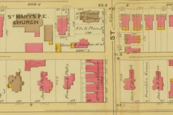
1892 Bromley map of the lower half of the sample quadrant of blocks, with St. Mary’s, Hamilton Village, Episcopal Church facing Locust Street. One of the many properties of the Eli K. Price estate is shown on the west side of 39th St.

1892 Bromley map of the upper half of the sample quadrant of blocks, dominated by mansions and greenspace owned by the financier Anthony J. Drexel, founder of the Drexel Institute of Art Science and Industry (now Drexel University).
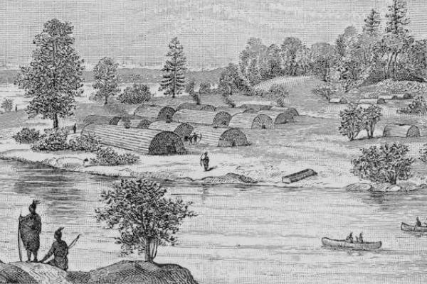
In Manhatta, the area that would become the Manhattan Borough of New York City, the Lenape lived in multi-family dwellings, in contrast to the smaller-sized wigwams of the Philadelphia region. This engraving from the late 19th century purports to describe a scene from 16th century Manhatta.
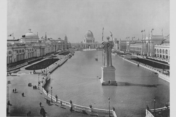
Exhibits from the 1893 Columbian Exposition—popularly known as the “White City”—were purchased by William P. Wilson to form the Philadelphia Commercial Museum.