
University City

Blockley Almshouse photographed in 1893, looking west from the area of the railroad trestle that crossed former Blockley property in the immediate vicinity of the river.

Blockley Almshouse depicted in 1857 in this view from the river.

Map of Blockley Township showing location of Blockley Almshouse in 1849.

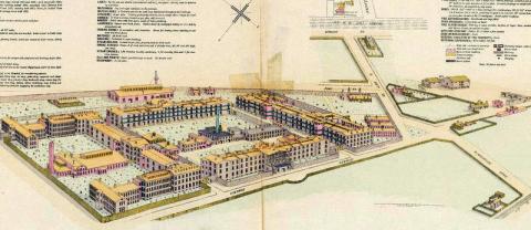
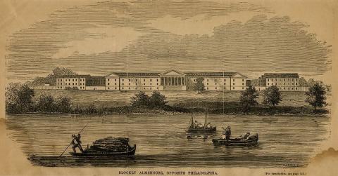
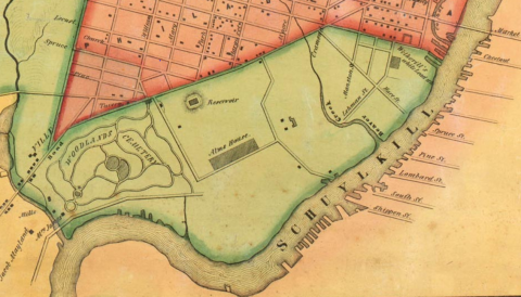
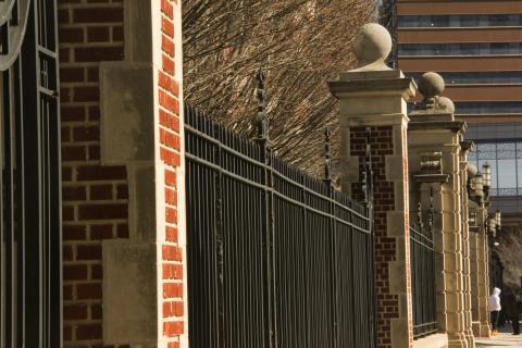
This photo shows the wrought-iron fence with its marble and inlaid-brick globe columns that marked the eastern boundary of the Philadelphia General Hospital, today facing Civic Center Boulevard/Ronald G. Perelman Way. The fence, which extends for several city blocks, is the only surviving remnant of the sprawling institution that once stood on this site, spanning the years 1834–1977, serving first as the City’s almshouse for indigent poor, next as the City’s only public hospital. 

Market Street Bridge and the Schuylkill River, 1900

In 1900, streetcars, carriages, and pedestrians shared the Market Street bridge across the Schuylkill River.

House Two, located at 3625 Walnut Street, was initially used while House One was prepared for occupancy and was later approved as the location for the second house.

Following World War II, urban renewal provided the resources for city officials and developers to create dramatic changes to the physical and social landscape of West Philadelphia.

This map, recreated from the Redevelopment Authority's 1965 Annual Report, represents the approximate boundaries of the major initiatives from 1948–1965.

A semi-aerial view southwest along Woodland Avenue near the intersection with 37th and Spruce Streets. Today a full-sized reproduction of a Woodland Avenue trolley can be found at this location on the north side of Spruce Street.  

View east from a ridge on Drexel University’s boundary that overlooks the Amtrak–SEPTA rail yards, the long-term, projected site of an over-build for development of University City’s Drexel-centric Innovation Neighborhood.

Pages