Landscapes in Overbrook
Part of
Part of
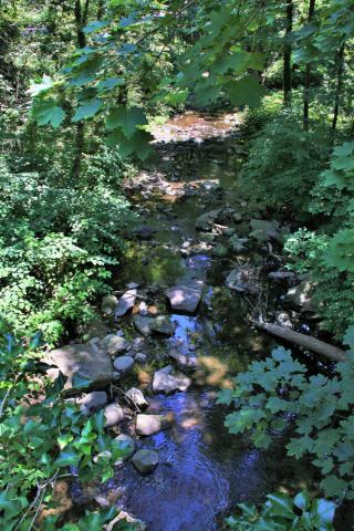
Morris Park
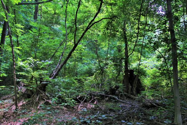
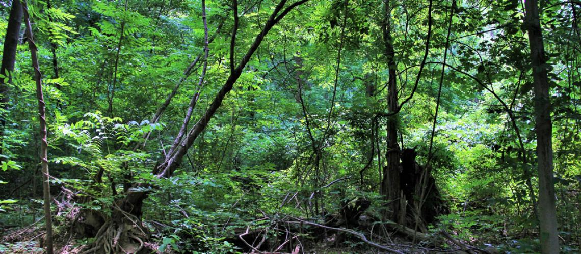
Dense woodland in Morris Park, parkland donated to the City by the Wistar Morris Estate in 1911, today part of the Fairmount Park system.
Photo by John Puckett
1700–1950
Mill Creek, Indian Run, Morris Park, and City Line are notable historical features of the Overbrook landscape.
Mill Creek, once a power source for sawmills and gristmills, achieved notoriety in the 20th century as an underground culverted sewer and submerged floodplain that wreaked havoc with the West Philadelphia landscape. Indian Run, an above-ground creek, powered Overbrook mill complexes as late as the 1890s. Morris Park, which includes Indian Run, is a preserved woodland, today part of the Fairmount Park system. City Line, which may have been a Lenape Indian trail, marks West Philadelphia’s western boundary, its most notable feature being the vehicular bridge above Overbrook Station.
Mill Creek
One tributary of this stream originates in a spring in Lower Merion Township, Montgomery County, and runs above ground north of 63rd and City Line Avenue. Once called “Nangensey” by the Lenape and “Nangenseykill” by the Dutch, the creek takes its English name from sawmills and grist mills that dotted its course in the Colonial period.[1] In the 1890s, the creek’s flow in Overbrook was routed into an underground culvert that formed part of the city’s sewer system. The creek entered the culvert on the Montgomery County side of City Line Avenue, across from Overbrook Station. The submerged creek/sewer ran southeast roughly paralleling the Pennsylvania Railroad tracks to 55th Street, where it turned more sharply southeast and flowed into the Schuylkill on a line with 43rd Street. The 1865 Barnes Map of Philadelphiashows the watercourse as it looked before it was culverted.
Once Mill Creek was in its tunnel, it was “forsaken and forgotten.” As Adam Levine writes, “It is not surprising that when a section of the Mill Creek sewer near 51st and Brown collapsed in 1961—swallowing up four houses and taking three lives—it was the first time many people in the Mill Creek area of West Philadelphia learned the origin of their neighborhood’s name.”[2]
Indian Run
Unlike Mill Creek, Indian Run, a Cobbs Creek tributary, remained for the most part above ground, its “east and west branches . . . preserved mostly intact in Morris Park.” The exception is a small stretch of the west branch where the stream, routed into a buried culvert, flows below a section of Morris Park and Landsdowne and Haverford Avenues.[3]
The west branch once provided the waterpower for dozens of flour, paper, and textile mills along its course. Philadelphia’s first mill, built by Swedes in 1642, stood here.[4]
As late as the 1890s, two mill complexes operated on Indian Run. The largest operation was the Coquanock Mills, near the intersection of Haverford and Landsdowne avenues.
Morris Park
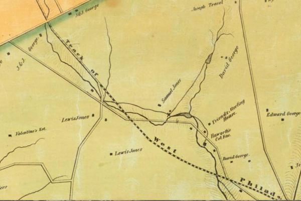
The land that became Morris Park in the 20th century was an extension of an estate acquired by William Morris in 1799 and held by three generations of the Morris family in the 19th century. In 1911, the Wistar Morris Estate donated Indian Creek and twenty acres of adjacent land to the city for the development of Morris Park—a tract that ran from Malvern Avenue to City Line between 66th and 70th streets.[5] A Bromley map from 1916 shows Morris Park and its adjacency to the Wistar Morris Estate. The park, now part of the Fairmount Park system, straddles the 66th Street boundary of Overbrook Farms.
City Line
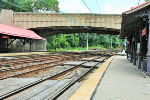
The original footprint of City Line, Philadelphia’s western boundary was reportedly a Lenape Indian trail. The line appears on the Holmes Map of 1681 as the dividing line between the Welsh Tract and the Liberty Lands. By the early 18th century the line separated Blockley Township from Marion Township. Built at the request of Edward Williams in 1705, a road covered the line “from the Ford at Schuylkill near Garrett Moreton’s up to Haverford Road.” Improvements to the road followed a resurvey of the boundary line in 1855.[6] In 1913, a concrete, single-span, barrel-arch bridge on City Line Avenue replaced a grade crossing over the east branch of Indian Run.[7] In 1935, the city spanned the Pennsylvania Railroad tracks at City Line Avenue just east of 63rd Street with a concrete, rigid-frame bridge (above the present-day Overbrook Amtrak station.)[8]
[1] Tello J. d’Apéry, Overbrook Farms: Its Historical Background, Growth and Community Life (Philadelphia: Magee Press, 1936), 52–54; Adam Levine, “A Brief History of the Overbrook Neighborhood, Focusing on Changes in the Natural Landscape,” a report for JASTECH Development Services,” accessed from http://www.phillyh2o.org/backpages/OverbrookHistory.htm, July 10, 2018.
[2] Levine, “Brief History of Overbrook.”
[3] Ibid.
[4] Levine, “Brief History of Overbrook”; Overbrook Farms Club, Overbrook Farms (Charleston, SC: Arcadia, 2014), 67.
[5] d’Apéry, Overbrook Farms, 55–56
[6] Ibid., 44–45.
[7] “City Line Avenue Bridge,” List of Bridges on the National Register of Historic Places in Pennsylvania, accessed from https://en.wikipedia.org/wiki/List_of_bridges_on_the_National_Register_of_Historic_Places_in_Pennsylvania, 22 July 2016.
[8] “Amtrak Overbrook Station Bridge,” Historic and Notable Bridges of the U.S., accessed from https://bridgehunter.com/pa/philadelphia/bh50397/#Map, 22 July 2016.
Morris Park
Dense woodland in Morris Park, parkland donated to the City by the Wistar Morris Estate in 1911, today part of the Fairmount Park system.
Photo by John Puckett
Related Media
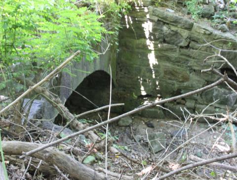
Mill Creek entering the sewer culvert on the Montgomery County side of City Line Avenue, opposite Overbrook Station, near City Line & 63rd Street.
John L. Puckett
East branch of Indian Creek in Morris Park near 66th Street & Overbrook Avenue.
John L. Puckett