Advanced Search
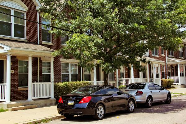
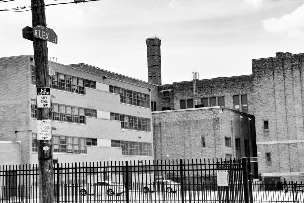
N. Lex Street as it appears today with the porticoed and rail-porched, accessorized redbrick rowhouses the Public Housing Authority built to replace the block’s decrepit and abandoned buildings, which the Authority bulldozed in 2002. Number 816 (at left in the photo), in its earlier coming-apart version, was the crack-house site of the notorious “Lex Street Massacre.”
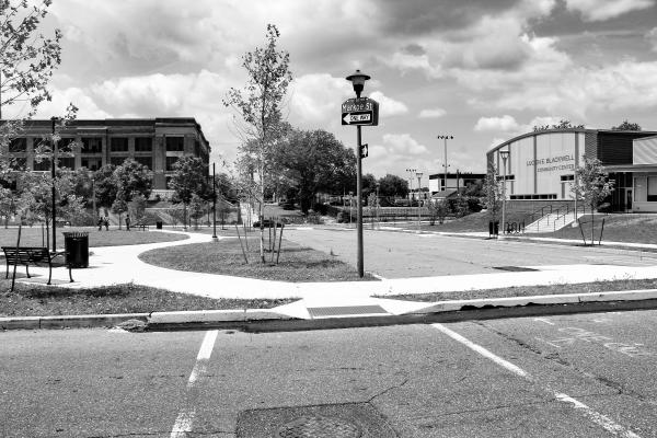
Looking west from N. Markoe St., the western boundary of Lucien E. Blackwell Homes. Shown here in their proximity to Parkway West High School (formerly Sulzberger Middle/Junior High School) are Lucien E. Blackwell Park and Lucien E. Black Community Center. The park is bounded east to west by N. Markoe and N. 47th Street. It lies on the buried floodplain of the Mill Creek sewer. Running along the base of the high school embankment, N. 47th Street charts the path of the buried sewer.
N. Markoe St., opposite Lucien E. Blackwell Park and Parkway West High School (formerly Sulzberger Middle/Junior High School), marks the western boundary of Lucien E. Blackwell Homes
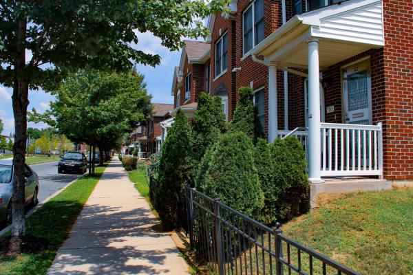
Lucien E. Blackwell Homes. N. 45th St. between Fairmount Ave. & Aspen St. spans a landscape that once housed the three apartment towers of Mill Creek Homes.
On the night of 28 December 2000, seven people died and three were wounded in an abandoned rowhouse on Lex Street in the immediate neighborhood of Mill Creek Homes. News media called it the worst mass murder in Philadelphia’s history. The ill-fated crack house, 816 Lex St., stood about a hundred yards from the Aspen St. entrance to the Martha Washington Elementary School playground.
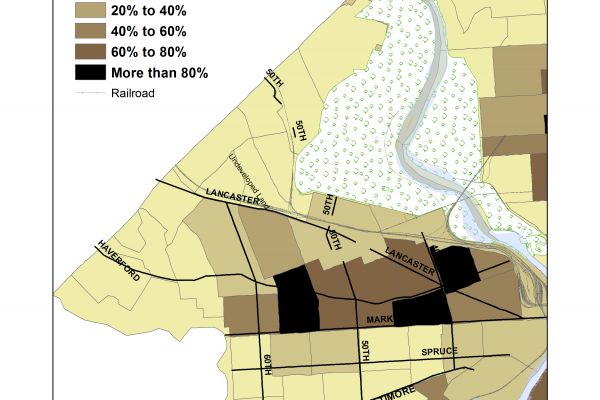
This digital map drawn from the 1950 U.S. Census shows the growing presence of blacks west of the Schuylkill River in 1950. The black presence in the Mill Creek neighborhood appears in the 60–80 percent range at mid-century.
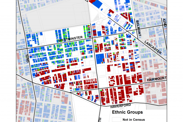
This digital map drawn from the 1940 U.S. Census shows the racial/ethnic configuration of the Mill Creek neighborhood before World War II. In 1940, the African-American population of West Philadelphia was concentrated within a few blocks north of Market St. Mill Creek was located at the center of that area. About 70 percent of the adult African Americans were born in southern states and moved north as part of the Great Migration.
Just under half of Mill Creek was white. Twenty-one percent of the adults were foreign-born. The majority was born in Ireland. Many of the Irish-born were Catholics, living near Cathedral Park Cemetery.
As shown here, the neighborhood is properly described as racially/ethnically “mixed.” Yet while blacks and whites lived relatively close to one another, Brown Street (visible though unnamed on this map) divided the predominately white—i.e., native-white and Irish-born—blocks above that street from the predominately black blocks below it.
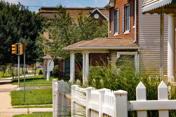
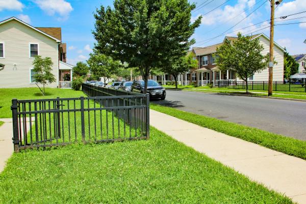
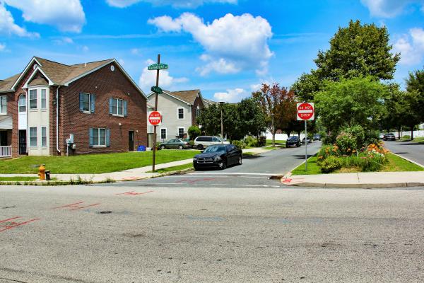
Lucien E. Blackwell Homes replacement housing on Aspen St., with Parkway West High School (formerly Sulzberger Jr. High/Middle School) in background. Two-storey twins of the kind shown here with redbrick facades, Doric columns, cultivated lawns, and wrought iron or picket fences, contribute to the suburbia-like ambience of the new housing development.
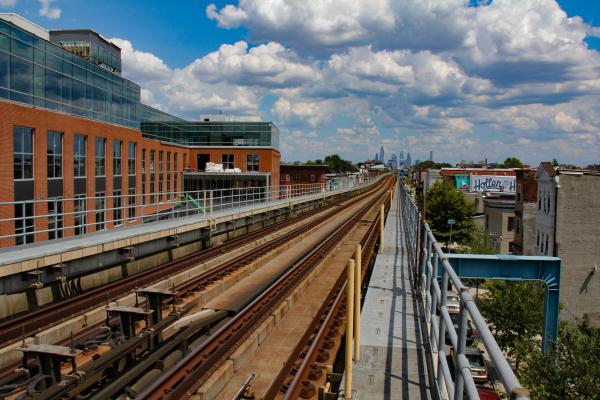
Looking east from the 56th St. station of the Market Street Elevated. Market St. is the boundary between the Haddington and Cobbs Creek neighborhoods. The station is nearly four miles from Center City’s towers, visible in the background.
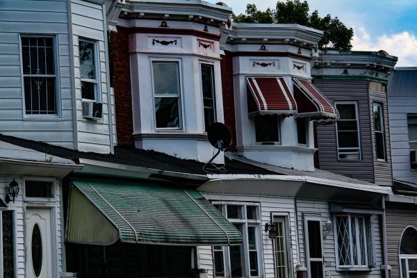
Haddington row houses on 53rd St. between Vine and Race.
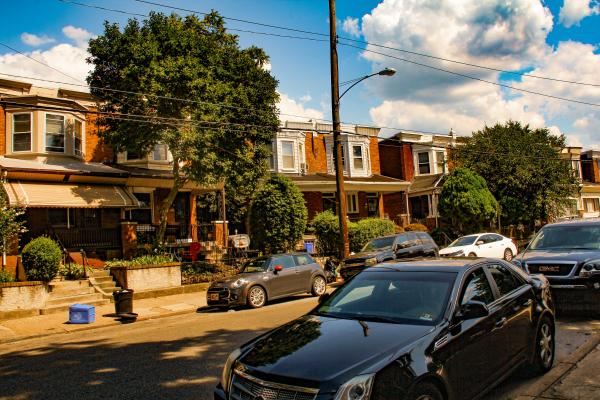
Looking south: 101 block Vodges near intersection with Race.