Advanced Search
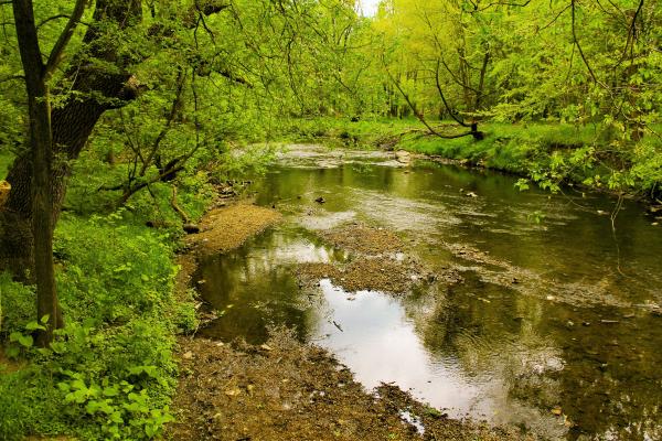
Today Cobbs Creek and the West End Mill meadow are in Cobbs Creek Park below the intersection of Catherine & 63rd Street (Cobbs Creek Parkway).
The meadow in which stood West End Mill. Today the site is in Cobbs Creek Park in the basin below the intersection of Catherine & 63rd Street (Cobbs Creek Parkway). There is no historical marker.
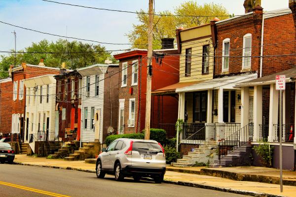
Contemporary photo of the 6100 block of Cedar Ave. shows West End houses that retain some of the original architectural features that marked them at the turn of the twentieth century.
This contemporary photo shows House One of the Free School fifty years after the alternative school opened. Straddling the corner of Walnut and 39th street, 3833 Walnut is still owned by the School District of Philadelphia.
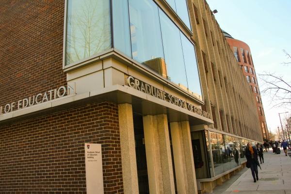
Penn GSE today faces Walnut Street. Fifty years after its involvement in developing the Free School, Penn GSE continues to prepare urban educators and assists local schools with curriculum and instruction, general planning, and resource development.
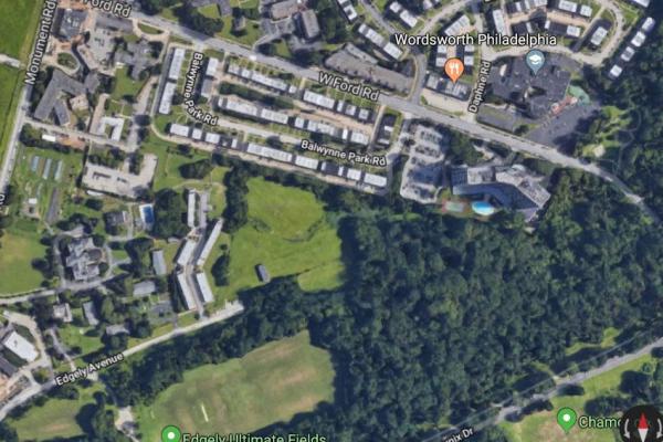
This Google Map aerial image shows the approximate location of woods and developed properties on land that was once the Woodside Amusement Park. In its 1950 photo information, the Philadelphia Evening Bulletin listed Woodside Park’s address as Monument and Ford roads.
Penn Tower, a grim modernist edifice that opened in 1975 on Convention Avenue as a Hilton Hotel morphed into an office building for HUP. This photo from 2013 shows Penn Tower between the University Museum and the Perelman Center for Advanced Medicine, with Convention Avenue separating the erstwhile hotel from the Perelman Center. The University demolished Penn Tower in 2015–16 to clear the site for construction of Penn Medicine’s Pavilion.
In 1999 Penn, under President Judith Rodin, completed the 14-story Biomedical Research Building II/III (or simply BRB II/III), which houses Ronald G. Perelman School of Medicine departments and centers for biological research. Standing on former PGH property at the western end of Osler Circle, BRB II/III is connected to the Medical School’s Stellar-Chance Laboratories by a bridge over Curie Avenue.
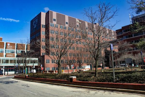
In 1989, the University of Pennsylvania, a PGH Development Corporation member, completed the Medical School’s Clinical Research Building on the west side of Osler Circle, with pedestrian access from the University campus and Curie Avenue.
This image shows the spatial relationship of the former PGH site to the Colket Translational Research Building, on CHOP’s Raymond G. Perelman Campus, near the south end of Civic Center Boulevard, which beginning at the Brueger Center for Advanced Pediatric Care also bears Perelman’s name.
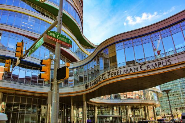
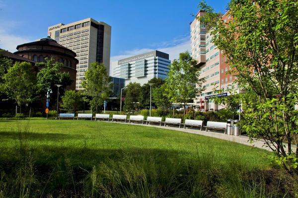
Constructed on former Civic Center land, CHOP’s eight-acre Raymond G. Perelman Campus, which honors Perelman’s donation of $50 million, includes two major buildings and a landscaped venue and walkway between the buildings, which have complementary functions. The campus is located just south of CHOP’s main hospital. This photo shows the Buerger Center for Advanced Pediatric Care, funded by Perelman. This 12-story facility provides state-of-the-art outpatient care for children and conducts clinical trials. Located on former Civic Center land just south of the Buerger Center is the Ruth and Tristram Colket, Jr. Translational Research Building, named for the building’s donors. At this state-of-the-art pediatric research building, research discoveries are “translated into new drugs, techniques and therapeutic approaches” that are applied at the Buerger Center as well at children’s healthcare facilities worldwide.
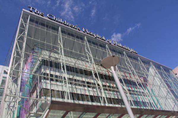
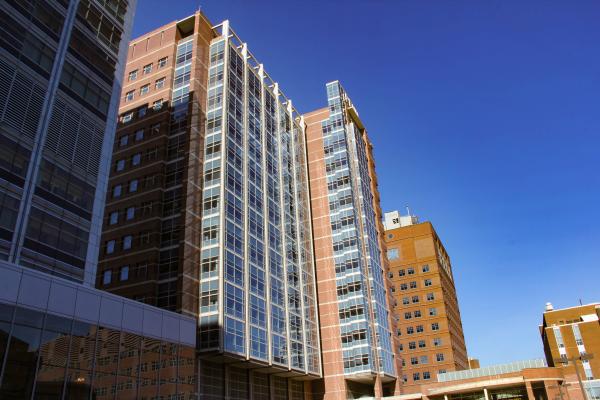
An internationally renowned institution, CHOP treats children suffering from various life-threatening illnesses and developmental disabilities. Completed in 1979, the main hospital, shown in this contemporary photo, was spectacularly renovated in the first decade of the Millennium and belongs to the healthcare complex that CHOP has built on both sides of Civic Center Boulevard since the 1990s.