
1950s

A semi-aerial view southwest along Woodland Avenue near the intersection with 37th and Spruce Streets. Today a full-sized reproduction of a Woodland Avenue trolley can be found at this location on the north side of Spruce Street.  

Crowds gather to watch the demolition of buildings along Woodland Avenue.

A mosaic displaying a bulldozer approaching a row of houses filled with African American residents.

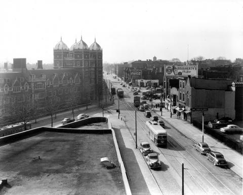
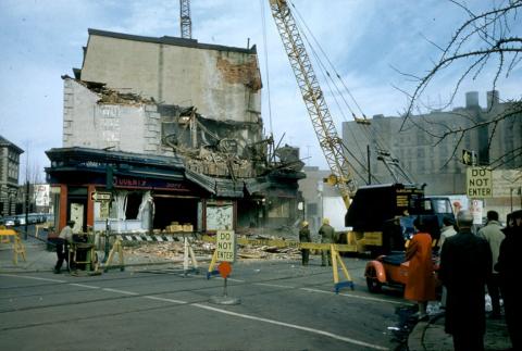
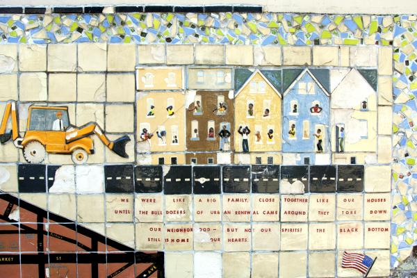
The University of Pennsylvania’s role in the creation of the University City Science Center in RDA Unit 3, a working-poor, majority-African American neighborhood known locally as the “Black Bottom,” severely damaged its community relations for decades to come.

Drexel’s campus expansion, funded by federal and city urban renewal dollars in the decades following World War II, brought the University into conflict, first with Penn and then with Drexel’s neighbors in Powelton Village.

The Drexel Institute of Technology’s successful efforts to receive half of University Redevelopment Area Unit 1—originally designated exclusively for the University of Pennsylvania’s campus expansion—asserted the Institute’s importance as a rising educational institution in West Philadelphia.

In the 1950s, the City facilitated Penn’s plans to create its modern pedestrian campus by putting the Penn trolleys underground and deeding the footprint of Woodland Avenue to the University. 

Looking northeast on Woodland Avenue between 36th and 34th Streets in the late 1950s.

Phases of the $100-million building program at the University of Pennsylvania are charted on an aerial photograph of the West Philadelphia area.

Woodside Park was an amusement park which thrilled Philadelphians with its attractions for almost 60 years.

Excited spectators pack the stands of the Arena at a 1966 76ers and Celtics game.

The Arena reached its peak in the post-war years with the emergence of professional basketball.

Pages