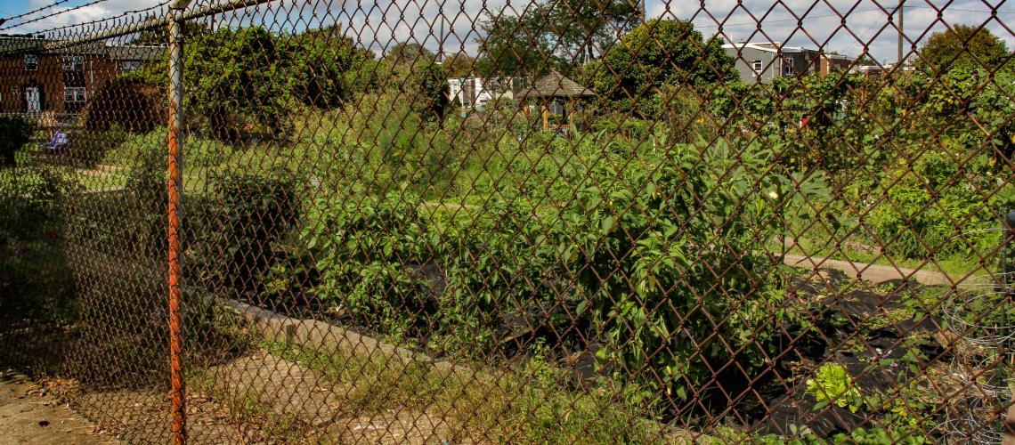
Aspen Farms Community Garden
Urban gardening today in Mill Creek's "buried floodplain" at 4837-59 Aspen Street, formerly a residential site. Established in 1975, with support from the Pennsylvania Horticultural Society.
Mill Creek
Aspen Farms Community Garden
Urban gardening today in Mill Creek's "buried floodplain" at 4837-59 Aspen Street, formerly a residential site. Established in 1975, with support from the Pennsylvania Horticultural Society.
Mill Creek, once a power source for various mills, achieved notoriety in the 20th century as an underground culverted sewer and submerged floodplain that wreaked havoc with the West Philadelphia landscape.
Mill Creek originated in Montgomery County and entered the area that became West Philadelphia at a point near the future intersection of City Line Avenue and 63rd Street. From there, it flowed southeast some five miles to the Schuylkill River below Baltimore Avenue, near the Woodlands Cemetery. In the early 19th century, Mill Creek was a power source for sawmills and gristmills. In the decades following the Civil War, the creek was enclosed in a brick-covered, culverted sewer and buried under mountains of landfill. The 20th century saw disastrous sewer collapses in this submerged floodplain. Since the late 1980s, the West Philadelphia Landscape Project has contributed academic resources to the study of the Mill Creek watershed and effective greenspace uses of abandoned properties occupying the ground above the buried sewer.
Stories in this Collection
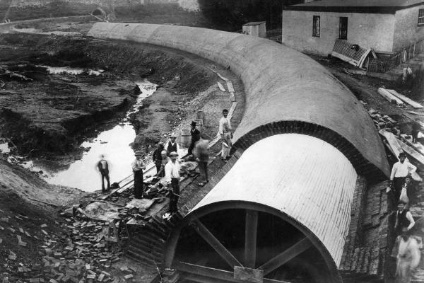 Originating in Montgomery County and entering the area that became West Philadelphia near the future intersection of City Line Avenue and 63rd Street, Mill Creek flowed southeast some five miles to its terminus in the Schuylkill River below Baltimore Avenue, near the Woodlands Cemetery. In the Colonial period, sawmills and gristmills were erected on the creek. By the mid-19th century, steam-powered textile mills were prevalent—notably John Buckman’s mill, located near the present-day intersection of 46th and Market streets. Beginning in 1869, the City moved this industrial creek, by now heavily polluted, into a culverted sewer, some 20 feet in diameter, and covered it with landfill to the level of city streets that would cross the submerged floodplain. |
 The late-19th-century city planners who oversaw the construction of the Mill Creek sewer did not foresee the powerful demographic and economic forces that would transform West Philadelphia’s landscape in the 20th century. The filling-in of the area’s population from City Line to the Schuylkill River and the ever-growing density of the “built landscape” of housing and commercial developments put extraordinary pressures on the sewer, which now had to absorb unmanageable amounts of raw sewage and stormwater. Consequently, the sewer occasionally overflowed and sometimes collapsed, the latter disasters leaving a trail of swallowed houses, undermined streets, and human fatalities. |
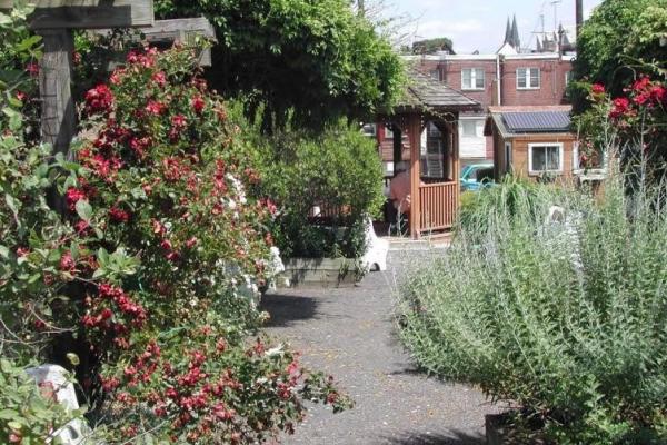 Since 1987, the West Philadelphia Landscape Project (WPLP), headed by Anne Whiston Spirn, a renowned landscape historian, first at the University of Pennsylvania, now at the Massachusetts Institute of Technology (MIT), has collaborated with West Philadelphia community allies and the Philadelphia Water Department in studying the Mill Creek watershed and helping to develop reclamation and education programs in the Mill Creek neighborhood. While working on a landscape design project, Spirn and her students collaborated with the urban gardener Hayward Ford and his Mill Creek community gardeners to redesign Aspen Farms, a capacious community garden built above the sewer’s landfill cover. In the late 1990s, Spirn formed a partnership with the Mill Creek Coalition to support WPLP’s Penn-student-assisted curricular projects at nearby Sulzberger Middle School, which focused on Aspen Gardens and Mill Creek’s submerged floodplain; among many other activities, Sulzberger youth worked with Philadelphia Water Department staff to build an outdoor classroom–environmental study area for the school, with a focus on stormwater management. |